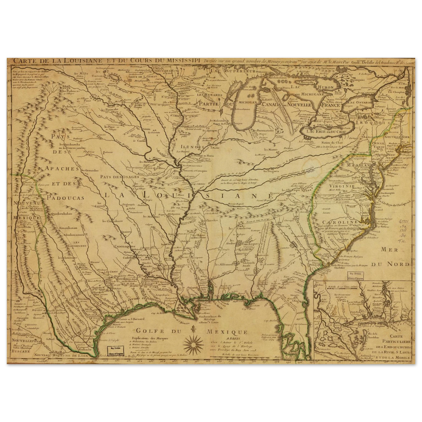
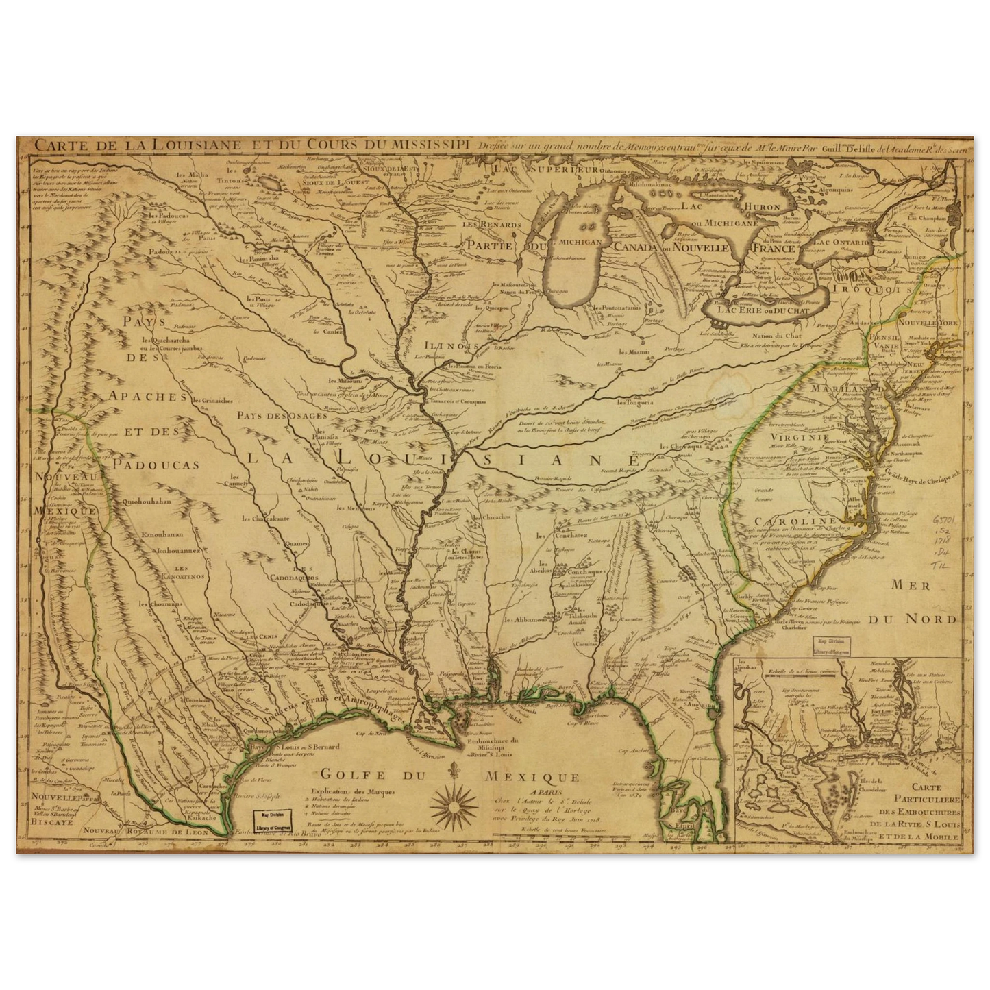
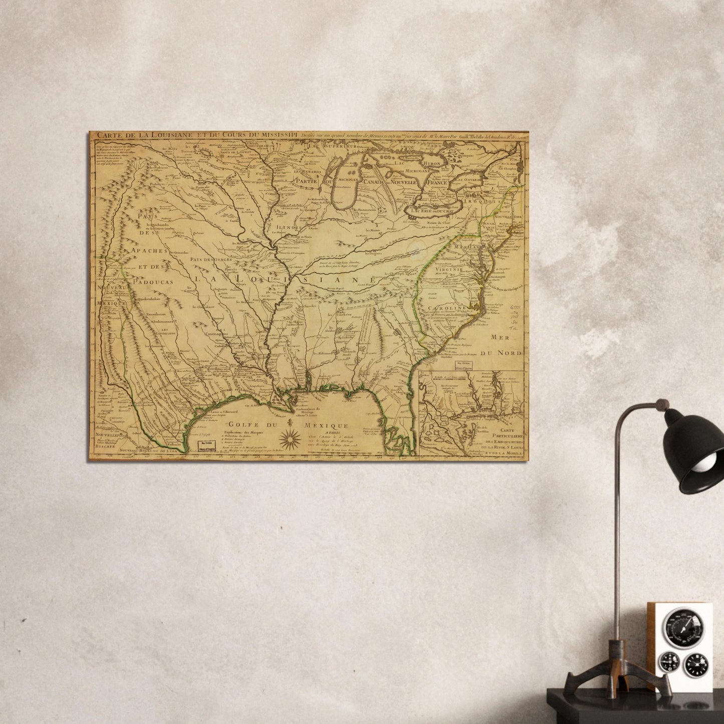
This is a 1718 map titled “Carte de la Louisiane et du Cours du Mississippi”, created by Guillaume de L'Isle, a prominent French cartographer of the early 18th century. It is one of the most important and influential early maps of the interior of North America.
📜 Historical Context & Significance
🗺️ 1. Depiction of French Colonial Ambitions
The map reflects France’s territorial claims in North America, especially the vast region known as Louisiana, which extended from the Gulf of Mexico to the Great Lakes and west toward New Spain.
The Mississippi River, prominently drawn, was the spinal cord of French exploration and commerce, linking scattered French forts and missions.
🏞️ 2. Early Geography of the American Interior
This was one of the first relatively accurate maps of the Mississippi River system based on actual exploration rather than speculation.
It shows Native American tribes (e.g., Padoucas, Apaches, Illinois, Cenis) and European settlements, giving insight into colonial encounters and rivalries.
📍 3. Key Locations
Nouvelle Orléans (New Orleans) is shown even though it was only founded that same year, 1718.
Inset map (bottom right) shows the mouth of the Mississippi in more detail, critical for trade and military strategy.
🔍 4. Scientific Mapping
De L’Isle was notable for applying rigorous methods using explorers’ journals, astronomical observations, and mathematical calculations.
This map marked a shift from decorative to data-driven cartography, influencing mapmaking for decades.
🛡️ Political Overtones
France’s claim to this territory was not merely academic—this map asserts imperial control in competition with Spain to the west and Britain to the east.
Maps like this functioned as propaganda, justifying France's colonial presence and ambitions in North America.
This map became widely copied and translated, shaping European perceptions of North America well into the 18th century. It’s a foundational document in the cartographic history of the U.S. interior.
Master's Edition archival paper, in off-white and uncoated, offers museum-quality for art enthusiasts seeking a luxurious way to enjoy world-class artworks:
Paper Finishing: Matte, uncoated, natural white (off-white).
Acid-Free: pH above 7 to prevent yellowing over time.
Paper Weight: 250 gsm (110 lb), Thickness: 0.29 mm (11.4 mils).
Sustainable Paper: FSC-certified paper for sustainability.
Learn about paper types and their unique textures and finishes here.